
Coat of Arms of Iguape: On the left side there are rice plants and on the right side sugar cane, representatives of the local economy, on the center there is the cross of the Order of Christ, typical Portuguese and among other symbols, there is the inscription "Virtvtes Pavlistarvm Retento" which means "Keeping the Paulista Virtue".

City: Iguape
Country: Brazil
State: São Paulo
My Commentary: I know Iguape since I was a child. It's with no doubt a town full of History and interesting sites to visit. Its colonial buildings are enchanting. Unfortunately the mayor and the other municipal politicians have been doing a terrible job these last decades and the town is deteriorating and many classic buildings are being lost. It's a pity considering that the essence of São Paulo's civilisation lies in that area.
History of Iguape: Because of its location, close to the limits established by the Tordesilhas Treaty, the Iguape region was the stage for constant disputes among Portuguese, Spanish, and French pirates who landed there in order to refill their vessels or to trade in their goods. The foundation of Iguape is sometimes attributed to Rui Garcia de Mosquera, a Spanish navigator and colonizer who established a good relationship with the Tupiniquin Indians.
In another unproved account, in 1498 a Spanish group landed in the region giving the name Iguape to a tiny village, in reference to a local Indian name for a common regional plant. Some years later, a French pirate vessel attacked Iguape and set fire to the village, destroying all official documentation. The veracity of those events is unknown, but there is no doubt that the first years of Iguape's history were strongly influenced by the presence of the Spanish.
With the discovery of gold at the end of the 16th century, Iguape was increasingly visited by adventurers searching for gold along the rivers. In 1635, there already existed the so-called "Casa da Oficina Real", the first money producing institution in Brazil (today Iguape's local museum). The discovery of gold at Serra da Paranapiacaba, in the interior of Vale do Ribeira, intensified the navigation of the Ribeira do Iguape river resulting in the formation of new villages such as Registro, Eldorado Paulista, Iporanga, Jacupiranga and Sete Barras.
Around 1780, the gold cycle had come to an end and many families left the region. Nevertheless, since the beginning of the 18th century the fertile grounds of the Ribeira valley were converted into large rice plantations. The rice, of an excellent quality, was intensively commercialized in Iguape and from there exported to Europe.
From 1820 to 1900, Iguape experienced a period of great prosperity reaching its economic peak. Five rice factories were working day and night, filling on average 10 large vessels per week. Banks were financing the business, six newspapers were circulated in the city, and France maintained a permanent consulate in the city. The population was accustomed to attending shows from Europe.
At that time, Iguape was as important as Rio de Janeiro or Salvador. Consequently the city had no difficulties in obtaining the necessary resources for the construction of one of the biggest and most controversial hydraulic installations on the Brazilian coast: The "Valo Grande" channel.
Aside from rice, other products from the Ribeira valley were transported by boat to a fluvial port at the shore of the Ribeira river close to Iguape and from there, via a terrestrial connection, to the marine harbor where they were loaded into big ships. To facilitate and cheapen transport, Iguape solicited permission from king D. Pedro II in order to open a 4 km long and 2 m wide channel, connecting the fluvial port in the west with the marine port in the east. The request was approved by D. Pedro and after hard work the construction was concluded in 1855.
The construction, meant to improve Iguape's economic conditions, did not account for the fact that the voluminous waters of the river, now with access to a shorter connection to the sea, were flooding away the sandy banks of the river, invading the areas close to the river and threatening the whole region.
With the natural destruction of the port, business turned inviable, resulting in quick economic deterioration of the region. Most people had to leave Iguape, and those who decided to stay experienced serious difficulties surviving by fishing and shrimping, which were significantly reduced in the coastal waters due to the large influx of fresh water. (Wikipedia)
Adeus, Iguape,
Adeus, terra querida,
És por todos chamada
A princesa dourada
Do Litoral Sul do Estado,
A mais bela e gentil,
A própria natureza te ornou
De graças mil.
Teu solo privilegiado pela natureza
Guarda em teu seio a maior riqueza
Bem-aventurado solo sem igual
Em todo o litoral,
És bela, tens os teus encantos
Cheios de alegria,
Reina em ti a doce paz,
Reina a alegria,
Ó Iguape amado, solo abençoado.
Adeus, Iguape,
Vou partir,
Adeus, adeus,
Profundos soluços e saudades
Levo de ti, terra amada,
Meu coração soluça e chora
Ao te deixar,
As saudades que levo de ti
Para sempre na campa há de findar.
Adeus, Iguape,
Adeus, terra querida,
És também conhecida
Terra do Bom Jesus,
Berço de vida e luz raiante,
Espalhando fulgores,
O teu porvir brilhante
Há de brotar igual às flores.
My Photos in Iguape - Trip 2014


My Commentary: I will sum it for now, after about 10 years without visiting our little house in Ilha Comprida, I finally went there with my family. Once there I had the ambitious idea of visiting my friends in the South of Brazil, since Ilha Comprida is in the South of São Paulo. At the end the plan worked better than I thought and I visited many places going by bus and then returning from the extreme South to my town by air plane. The list above follows the sequence of the route I did. It's possible to click in all the towns and get information and photos:
São Paulo
Paraná
Santa Catarina
Rio Grande do Sul
Here below there is a picture with some stuff I brought from all the places I visited.

My Photos in Iguape - Trip 2014
My Commentary: As for Ilha Comprida, I was about 10 without visiting Iguape. This town is part of my infancy and seeing it again was important for me. Its colonial style had my attention since I was a child but as an adult now I see that negligence is the key word for Iguape. Politicians nor its citizens care too much about the place and while Ilha Comprida (an island in front of it) is growing up and getting structure, Iguape is stopped in time (in the negative way of the therm). Apart of all this it's still possible to visit places and search for interesting spots to visits, as shown below.


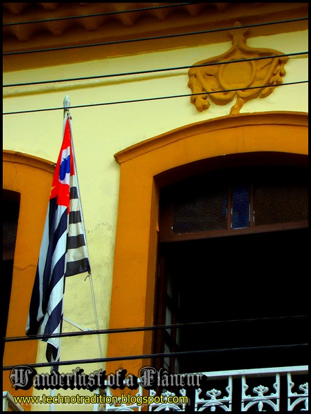
City Council of Iguape


A monument for the first settlers of the region (Cananéia, Iguape and Ilha Comprida), who were the first European settlers in here of what is today Brazil.

A monument for the first settlers of the region (Cananéia, Iguape and Ilha Comprida), who were the first European settlers in here of what is today Brazil.


Back of the monument


Museum of Iguape: Representing the Native Indian tribes

Museum of Iguape

Museum of Iguape

Explanation about the first human settlers in the region ( about 7.000 years ago)


Participation of Iguape at the Paulista Revolution in 1932: Holding a gun used on the Civil War

Participation of Iguape at the Paulista Revolution in 1932

Participation of Iguape at the Paulista Revolution in 1932: A ham radio


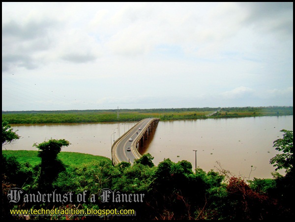
Mayor Laércio Ribeiro bridge which connects Iguape and Ilha Comprida


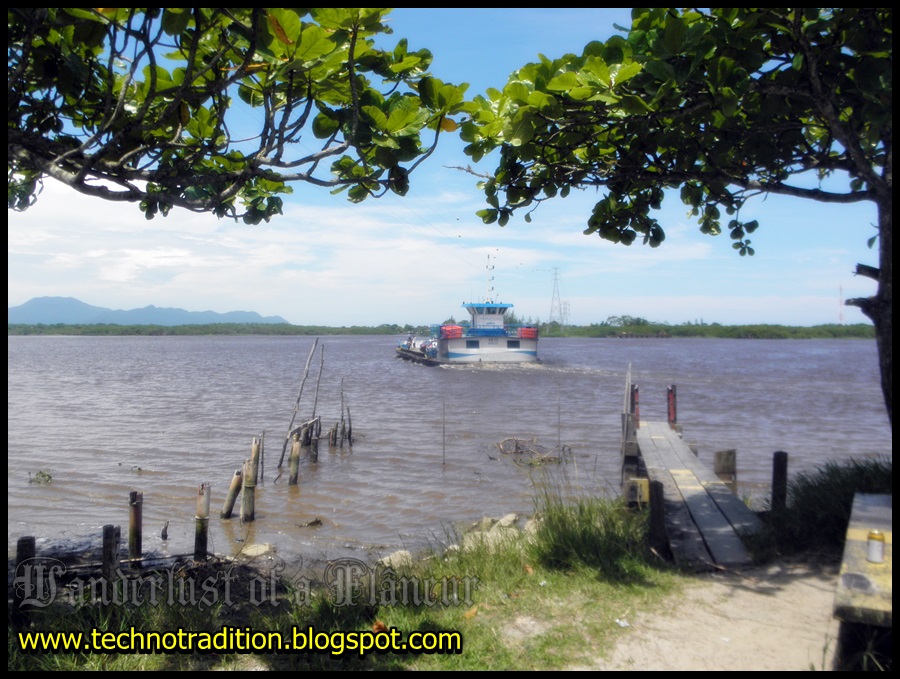
Ferry Boat to Juréia

House at Praça Nossa Senhora da Conceição (Icapara)

House at Praça Nossa Senhora da Conceição (Icapara)

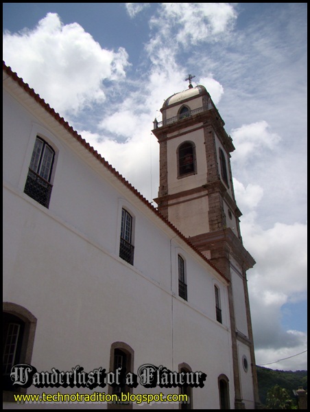
Roman Catholic Church at Praça Nossa Senhora da Conceição (Icapara)


View from Christ Belvedere at Morro do Espia

View from Christ Belvedere at Morro do Espia

View from Christ Belvedere at Morro do Espia

Christ the Redeemer at Morro do Espia

View from Christ Belvedere at Morro do Espia

View from Christ Belvedere at Morro do Espia: The Mormom Church

View from Christ Belvedere at Morro do Espia: Ilha Comprida

View from Christ Belvedere at Morro do Espia

View from Christ Belvedere at Morro do Espia: Historical buildings being devastated by time and indifference

View from Christ Belvedere at Morro do Espia: The main road of Iguape (at left) as ugly as a communist African country. It must be restored and made beautiful in respect to the historical importance of Iguape.


The Polish friend of ours
My Photos in Iguape in 2016

My commentary: Iguape is still a wonderful place, hidden in the nature area, but the indifference of the local politicians to the town's History is still reality. The main avenue is ugly and it's easy to see the lack of care. It's summer so the temperature there is around 28 degrees normally. The options of restaurants are not so great, but it's possible to eat cheap. I didn't take too many pictures because I took the care of not being so repetitive considering the photos I took in 2013.


Historical buliding restored: Elderly Support Group


My Photos in Iguape in 2017


Christian "cave" at Parque da Fonte


My Photos in Iguape in 2018


A monument for the first settlers of the region (Cananéia, Iguape and Ilha Comprida), who were the first European settlers in here of what is today Brazil.


The are where Praia do Leste (East Beach) was has been suffering erosion and some years ago a whole amount of land disappeared, consuming the area where the beach used to be. I've been photographing this area since 2014.

Praia do Leste: The houses near this beach were taken during a flood and now the waters didn't get back as before, not allowing the houses to be rebuilt at the same place they were. (2014)

Praia do Leste (2014)

Praia do Leste (2014)

Praia do Leste (2014)


Praia do Leste (2017)


 |
| Photo taken from a place where it's possible to see the 3 points (from different towns) which have been affected by erosion (2018) |

Photo taken from a place where it's possible to see the 3 points (from different towns) which have been affected by erosion (2018 - zoom from the photo's place above)
No comments:
Post a Comment